
AGV navigation & AGV AMR navigation method selector
Pick the right navigation method for your automated guided vehicle or autonomous mobile robot fleet. Enter your fleet, accuracy, flexibility, budget, and environment constraints to get a scored recommendation with accuracy ranges, cost bands, and reconfiguration trade-offs, then read the full method and evidence report below.
Methods scored
5
tape · QR · LiDAR · vision · beacon
Accuracy range
±3-40 mm
method-dependent
Decision mode
4 criteria
accuracy · flex · cost · env
Deployment
1-3 weeks
mapping → beacon calibration
Canonical path: /learn/agv-navigation · covers the alias agv amr navigation
Published - Last updated
Range 1-500
Lower = tighter tolerance. Map to actual docking tolerance.
Enter your constraints and press Run selector to see the recommended navigation method.
Key conclusions on AGV & AMR navigation
Five evidence-backed conclusions for fleet architects evaluating navigation methods. Each is traceable to the method, accuracy, and source tables below.
Suitable for
Indoor AGV/AMR programs that can define accuracy, flexibility, budget, and environment constraints and run a mapping pilot before fleet-wide procurement.
Not suitable for
Frozen specs demanding ±5 mm accuracy, free roaming, and low cost simultaneously; outdoor-only fleets without beacon infrastructure; programs that cannot pilot.
AGV navigation vs AMR navigation
The alias "agv amr navigation" spans both categories. The distinction is behavioural (replanning logic), not just the sensor hardware.
| Dimension | AGV navigation | AMR navigation |
|---|---|---|
| Path definition | Fixed path (tape, wire, markers) | Computed dynamically from a map |
| Obstacle response | Stop and wait for clearance | Replan around the obstacle |
| Typical sensor | Magnetic / camera line follower | LiDAR or camera SLAM stack |
| Reconfiguration | Physical infrastructure change | Software remap |
| Positioning accuracy | Higher (constrained path) | Moderate (map-dependent) |
| Best deployment | Predictable, high-throughput loops | Variable, human-shared spaces |
| Fleet comms | VDA 5050 compliant (orders along fixed nodes/edges) | VDA 5050 compliant (defined as "free navigation AGVs") |
| Safety sensor | PL d / Type 3 area scanner (ISO 3691-4) | PL d / Type 3 area scanner (ISO 3691-4) |
Method, accuracy & evidence
How each navigation method works, its typical repeatability, and the evidence basis. Numbers are vendor-nominal unless stated.
Typical repeatability
Lower bars are better. Ranges reflect published nominal repeatability, not guaranteed field accuracy.
Reconfiguration effort by method
How much work is required to reroute when the layout changes.
| Method | Repeatability (mm) | Drift over 30 m | Relocalisation | Evidence |
|---|---|---|---|---|
| Reflective beacon | 3-8 | Negligible (absolute fix) | Instant on beacon sighting | vendor-nominal |
| QR marker | 5-12 | Reset at each marker | Per-marker reset | vendor-nominal |
| Magnetic tape | 8-15 | Bounded by line tracking | Continuous on tape | vendor-nominal |
| LiDAR SLAM | 15-30 | 5-15 mm if features stable | Scan-match relocalisation | vendor-nominal |
| Vision SLAM | 20-40 | 10-25 mm, lighting dependent | Visual feature re-detect | vendor-nominal |
| Method | Per-vehicle hardware | Infrastructure | Fleet scaling | Evidence |
|---|---|---|---|---|
| Magnetic tape | Low (line sensor) | Tape / embed full route | Low marginal cost | market-range |
| QR marker | Low-mid (camera) | Marker stickers on floor | Low marginal cost | market-range |
| LiDAR SLAM | High (2D/3D LiDAR + compute) | Mapping only | High per-vehicle cost | market-range |
| Vision SLAM | Mid-high (cameras + compute) | Mapping only | Mid per-vehicle cost | market-range |
| Reflective beacon | Mid-high (laser scanner) | Wall/column reflectors | Beacons shared across fleet | market-range |
Odometry: the foundation every method builds on
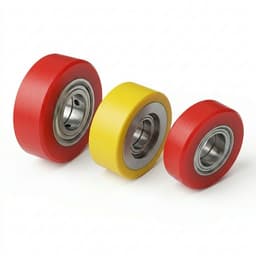
All five methods fuse their correction onto a wheel-odometry motion model. The drive wheel, encoder and tyre set the accuracy floor no method can beat. Typical un-fused differential-drive odometry drifts on the order of 1–2% distance error and 2–3° heading error over 100 m; pure odometry is unreliable beyond ~10 m without re-localisation.
| Error source | Type | Effect | Mitigation |
|---|---|---|---|
| Wheel slip / skid | Non-systematic | Measured wheel travel exceeds ground travel; position overestimated, worst on smooth/wet floors and hard acceleration. | High-traction tyres, gentler acceleration profiles, and IMU/LiDAR fusion via an EKF. |
| Wheel diameter mismatch | Systematic | Unequal effective radii produce a scale bias that curves every straight path. | Calibrate kinematic parameters (e.g. UMBmark test); use matched drive wheels. |
| Wheelbase uncertainty | Systematic | Heading bias on every turn; accumulates as lateral drift. | Measure the effective track precisely, or use unloaded passive encoder wheels. |
| Encoder quantisation | Systematic | Discrete pulse counts add integration noise (~0.3 mm per pulse at 1000 ppr on a 0.1 m wheel). | Higher PPR encoders (≥1000–2000; 4000+ for precision). |
| Floor roughness / unevenness | Non-systematic | Random heading and distance noise that grows with distance. | Periodic relocalisation on markers, beacons, or SLAM scan-match. |
Standards & safety framework
Choosing a navigation method and passing the safety case are separate decisions. The standards below govern AGV/AMR deployments regardless of whether you run tape, markers, SLAM or beacons.
| Reference | Scope | Key requirement | Evidence |
|---|---|---|---|
| ISO 3691-4 (2023) | Industrial trucks — safety of driverless trucks (AGV/AMR) — Type-C product-safety standard for AGV, AMR, AGC and similar trucks per ISO 5053-1. | Mandates hazard/risk assessment (Annex B), personnel detection, braking, speed control and stability; adopts ISO 13849 performance levels for safety functions. In an operating hazard zone with no pedestrian escape route (≥0.5 m × 2.1 m), personnel detection must cover to within 180 mm of surrounding objects. | primary-standard |
| EN ISO 13849-1 | Safety-related parts of control systems (performance levels) — Functional-safety framework assigning performance levels a–e from severity, exposure and avoidability. | AGV/AMR safety functions typically require PL d (Category 3), equivalent to SIL 2 — a dangerous-failure rate of 10⁻⁷ to <10⁻⁶ per hour. Determines whether the navigation/safety stack is certifiable, independent of which navigation method is chosen. | primary-standard |
| IEC 61496-1 / -3 | Electro-sensitive protective equipment (ESPE), Type 3 — Construction and testing of safety laser scanners used for person detection on moving vehicles. | Certifies the area scanner used for the safety stop. The protective field (stop) is distinct from warning fields (slow/pre-warn), which must not be relied on for personnel protection. | primary-standard |
| VDA 5050 v2.0 (Jan 2022) | AGV/AMR ↔ master-control communication interface — Open JSON-over-MQTT interface so mixed-vendor AGVs and AMRs share one fleet manager. AMRs are defined as "free navigation AGVs". | Standardises orders, nodes, edges, state and instant actions — not a full control system. At the VDMA AGV Mesh-up (2023) a heterogeneous fleet was integrated in under two days. Relevant once an AMR fleet needs a single master control regardless of vendor. | primary-standard |
Safety-rated area scanner is mandatory, not optional
Under ISO 3691-4, person detection must reach PL d / SIL 2 via an IEC 61496-3 Type 3 safety laser scanner. The navigation LiDAR (used for SLAM) is usually a separate, non-safety-rated sensor. Common safety scanners: SICK microScan3 / nanoScan3, KEYENCE SZ-V / SZ, OMRON OS32C (all Type 3 · SIL 2 · PL d). Detection resolution: ~30/40 mm = hand, ~50/70 mm = leg, ~150 mm = body.
| Scanner class | Rating | Detection note | Typical use |
|---|---|---|---|
| SICK microScan3 / nanoScan3 | Type 3 · SIL 2 · PL d · IP65 | 30/40 mm = hand, 50/70 mm = leg, 150 mm = body (per SICK documentation). | Mobile hazardous-area protection on AGVs/AMRs; protective + warning field switching by speed. |
| KEYENCE SZ-V / SZ | Type 3 · SIL 2 · PL d · Cat 3 | Up to four simultaneously monitored protective fields; muting and bank settings. | AGV safeguarding and robotic-cell guarding; alternative to hard guarding and safety mats. |
| OMRON OS32C | Type 3 · SIL 2 · PL d | Configurable protective/warning fields; PROFINET/EFI options. | AGV/AMR person protection and access guarding. |
Research basis updated 2026-06-17. Standard editions: VDA 5050 v2.0.0 (January 2022); ISO 3691-4 current edition 2023. Scanner models listed are representative examples, not endorsements.
Comparison, trade-offs & risks
Side-by-side comparison, the cost-accuracy frontier, deployment scenarios, and the risks of mis-selecting a navigation method.
| Method | Accuracy | Flexibility | Cost | Reconfig | Best for | Main limit |
|---|---|---|---|---|---|---|
| Magnetic tape | ±10 mm | Fixed line only | $ (lowest) | High (re-tape floor) | High-throughput repeatable loops | Tape wear; no dynamic rerouting |
| QR / fiducial marker | ±8 mm | Grid-based, semi-flexible | $$ | Medium (re-stick markers) | Dense warehouses with shelf aisles | Markers can be obscured or damaged |
| LiDAR SLAM | ±20 mm | Free roaming | $$$$ (highest) | Low (remap only) | Dynamic, frequently changing layouts | Feature-poor aisles degrade localisation |
| Vision SLAM | ±25 mm | Free roaming | $$$ | Low (remap only) | Cost-sensitive free-roaming indoor fleets | Sensitive to lighting and visual symmetry |
| Reflective beacon | ±5 mm | Open-area triangulation | $$$ | Medium (relocate beacons) | Large open bays needing high repeatability | Line-of-sight to beacons required |
Cost vs accuracy frontier
The top-left quadrant (high accuracy, low cost) is empty by design, reflecting the fundamental trade-off.
Input: 24 vehicles · ±15 mm · fixed · low budget
Recommended: Magnetic tape navigation (100/100)
Magnetic tape navigation meets all four constraint criteria for your AGV/AMR navigation profile. Accuracy, path flexibility, budget tier, and environment are all within the method's defensible envelope.
Input: 12 vehicles · ±25 mm · free-roaming · high budget
Recommended: Vision SLAM / VSLAM (112/100)
Vision SLAM / VSLAM meets all four constraint criteria for your AGV/AMR navigation profile. Accuracy, path flexibility, budget tier, and environment are all within the method's defensible envelope.
Input: 6 vehicles · ±5 mm · semi-flexible · mid budget
Recommended: Reflective beacon / grid navigation (100/100)
Reflective beacon / grid navigation meets all four constraint criteria for your AGV/AMR navigation profile. Accuracy, path flexibility, budget tier, and environment are all within the method's defensible envelope.
Input: 8 vehicles · ±5 mm · free-roaming · low budget
Recommended: Vision SLAM / VSLAM (62/100)
Your accuracy, flexibility, and budget constraints conflict. No single navigation method satisfies all criteria at once. Relax at least one constraint before sourcing navigation hardware.
| Risk | Trigger | Impact | Mitigation |
|---|---|---|---|
| Accuracy gap in feature-poor aisles | Long straight corridors with few geometric features | High | Add fiducial markers as localisation anchors, or fall back to reflective beacons in those aisles. |
| Tape / marker damage | Forklift traffic, floor cleaning, spills | Medium | Schedule marker inspection, use recessed tape, and keep a replacement-marking runbook. |
| Map drift after layout change | Racking moved or pallets repositioned without remap | High | Trigger a remap after any documented layout change and version-control the map. |
| Cost overrun on large SLAM fleets | Scaling LiDAR SLAM beyond 20+ vehicles | Medium | Hybridise: SLAM for flexible zones, markers for fixed high-throughput loops. |
| Lighting sensitivity (vision SLAM) | Aisles with strobe, glare, or low-light shifts | Medium | Add active illumination or switch those zones to LiDAR SLAM. |
| Over-specifying accuracy | Requesting ±5 mm when pick faces tolerate ±25 mm | Low | Map accuracy to the actual docking tolerance, not a round number. |
Frequently asked questions
Grouped by topic. Covers both "agv navigation" and the alias "agv amr navigation".
AGV/AMR navigation basics
Choosing a navigation method
Cost and deployment
Accuracy, risk, and validation
Evidence basis & sources
Accuracy and cost claims are traced to source categories. Where open cross-vendor evidence is incomplete, the status is marked explicitly.
| Source | Scope | Date | Status | Note |
|---|---|---|---|---|
| Navigation method accuracy ranges | Vendor datasheets and integration guides | 2024-2026 | Partially known | Reported as nominal repeatability under controlled indoor conditions; field performance varies. |
| Per-vehicle cost bands | AGV/AMR integrator quotations and market ranges | 2024-2026 | Partially known | Cost indices are relative bands, not fixed prices; request live quotes for current figures. |
| AGV vs AMR behavioural distinction | Industry association definitions | 2023-2026 | Known | AGV = fixed-path / stop-on-obstacle; AMR = dynamic replanning. Boundary blurs in marketing copy. |
| Reconfiguration effort ranking | Integration case studies | 2024-2026 | Partially known | SLAM remap is faster than physical tape/marker relocation, but remap quality depends on operator skill. |
| Safety framework (ISO 3691-4 · EN ISO 13849-1 · IEC 61496-3) | Primary international standards (type-C + functional safety + ESPE) | 13849 / 61496 current; ISO 3691-4 edition 2023 | Known | AGV/AMR safety functions require PL d (Cat 3, SIL 2) person detection via a Type 3 safety area scanner. Applies to every navigation method. |
| VDA 5050 fleet communication interface | VDA / VDMA open standard (JSON over MQTT) | v2.0.0, January 2022 | Known | Standardises AGV/AMR ↔ master-control messaging; AMRs are "free navigation AGVs". Enables mixed-vendor fleets under one fleet manager. |
| Wheel-odometry error model | Mobile-robotics literature (systematic vs non-systematic error) | 2018–2025 | Partially known | Slip, tyre mismatch, wheelbase uncertainty and encoder quantisation accumulate; ~1–2% distance / 2–3° heading per 100 m is engineering-typical, not a guaranteed figure. |
- VDA 5050VDA / VDMA · v2.0.0, January 2022VDA 5050 v2.0.0 — Interface for communication between AGVs/AMRs and master controlChecked 2026-06-17
- ISO 3691-4ISO · Current edition 2023Industrial trucks — Safety requirements and verification — Part 4: Driverless industrial trucksChecked 2026-06-17
- EN ISO 13849-1Pilz (standards reference) · Reference pageSafety-related parts of control systems — performance levels (PL d)Checked 2026-06-17
- IEC 61496-3SICK (product documentation) · Datasheet compendiumSafety laser scanners (microScan3 / nanoScan3): Type 3 · SIL 2 · PL d dataChecked 2026-06-17
- ROS 2 Nav2Open Robotics / ROS 2 · 2025Navigation stack — AMCL localisation, costmaps, replanningChecked 2026-06-17
- Odometry errorMDPI Robotics, 13(1):7 · 2025Online odometry calibration in low-traction conditions (systematic vs non-systematic error)Checked 2026-06-17
Next steps
Run the selector
Enter your fleet constraints above to get a scored recommendation before talking to suppliers.
Plan a mapping pilot
For review-band results, budget a 2-4 week pilot to measure repeatability over a representative traverse.
Request an architecture review
For conflicting constraints, request a navigation architecture review to find a hybrid method set.
Related engineering resources
Continue with adjacent drivetrain checks, navigation evidence review, and direct RFQ actions.
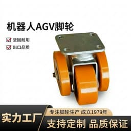 Run the AGV/AMR navigation method selector
 Method, accuracy & evidence for navigation decisions
 Navigation comparison, trade-offs & risk section
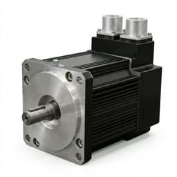
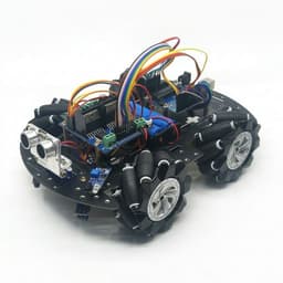 AGV motor pre-screen for the full motion stack
- Differential drive checker for drivetrain context
 AGV and AMR Adoption in Factories
 Request a navigation architecture review